The History of A1A Through Vero Beach
The road every visitor drives and every owner uses daily was a sand track within living memory.
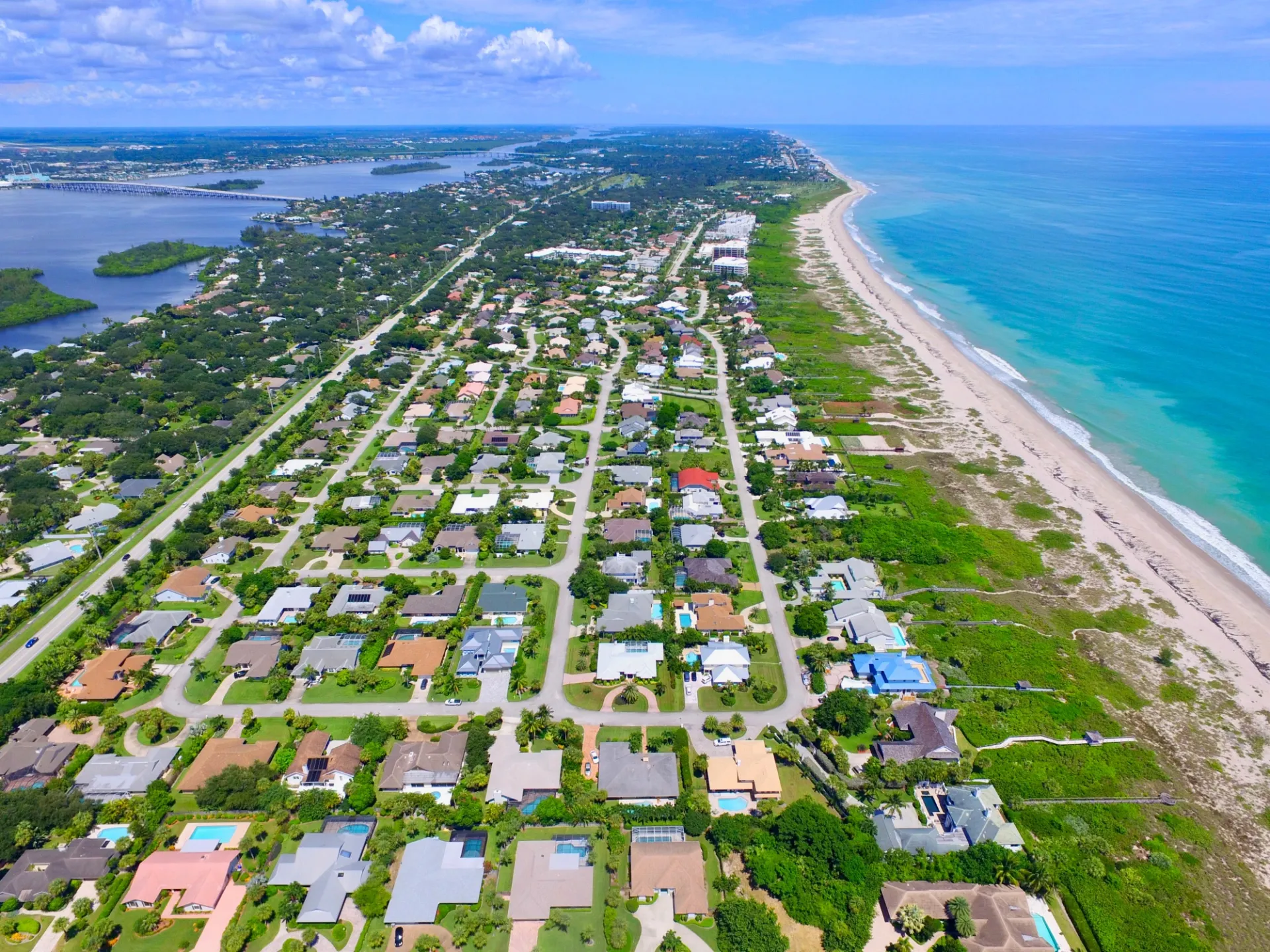
State Road A1A runs the length of the Vero Beach barrier island, the road every visitor drives and every owner uses daily. It looks permanent. It is not. The corridor was a sand track that washed out in storms within living memory, a wartime patrol route, a citrus-haul road, and a bridge-by-bridge construction project that took most of the twentieth century to finish. The road's history is the island's history.
Before the Pavement
The barrier island was reachable by boat for most of the nineteenth century. Pineapple growers, fishermen, and a small group of homesteaders worked the land. There was no continuous road. Movement up and down the island happened on the beach itself at low tide, or on the rough sand cuts that ran behind the dune line.
The earliest formal road south of Sebastian Inlet ran on the mainland, not the island. Crossing to the beach meant a small boat or, by the early twentieth century, a wooden swing bridge. The barrier island was a destination, not a corridor.
The First Bridges
The original wooden bridge into the barrier island near present-day Beachland Boulevard was built in 1920, the year Vero officially incorporated. The crossing turned a boat trip into a drive, and the development of the central island accelerated quickly afterward. Riomar Country Club had already opened in 1919, anticipating the bridge. The Driftwood Inn followed in 1935.
The bridge was upgraded several times across the next half-century. The current Merrill P. Barber Bridge, named for the Vero Beach mayor and businessman, opened in 1994 in its modern fixed-span form. The 17th Street crossing, now the Alma Lee Loy Bridge, replaced an earlier drawbridge. The Wabasso Causeway connected the north end of the island to the mainland and remains the only formal crossing for north-island residents.
A1A as a Patrol Route
During World War II, the Atlantic coast was an active wartime corridor. German U-boats operated within sight of Florida beaches in 1942 and 1943, sinking merchant ships within view of barrier island residents. Coastal patrols rode A1A on horseback and in vehicles, scanning the dune line for survivors of torpedoed ships and for landing parties. Tar washed up on the beach for years afterward from ships sunk offshore. The road carried that history into the postwar era.
The Citrus Years
Citrus shaped the inland economy of Indian River County for decades. The barrier island itself was not a major citrus growing region (the soil and salt did not cooperate), but A1A served as a haul road for fruit moving between coastal packinghouses and the rail and shipping points on the mainland. The Indian River Citrus brand became one of the most recognized in American produce, and A1A was part of how it moved.
The Storms That Reshaped the Road
Hurricane Donna in 1960 cut into the dune line in several spots and forced the first significant beach renourishment conversations on this part of the coast. The 1962 Ash Wednesday storm did similar damage further north. Each storm prompted reroutes, re-engineering, and dune reconstruction along A1A.
The defining storms in modern memory were Frances and Jeanne in 2004, three weeks apart. The barrier island took direct hits from both. A1A was undermined in places, the dune line was breached in several locations, and the rebuild that followed redefined the standards under which the road and adjacent properties have been built ever since. (For the full picture on codes and insurance, see Hurricane and Insurance Reality on the Barrier Island.) The current corridor reflects the post-2004 generation of coastal engineering.
What's There Today
A1A on the barrier island runs roughly seventeen miles from Round Island in the south to Sebastian Inlet in the north. Along the way, the road threads through:
- The south island stretch: Round Island Park, Castaway Cove, and The Moorings.
- The Central Beach village: Sexton Plaza, Ocean Drive, Cardinal Drive, Humiston Park, the Vero Beach Hotel and Spa, Costa d'Este, and the Driftwood Inn.
- The north island clubs: John's Island, Indian Trails, Sea Colony, Bermuda Bay, Sea Oaks, and Quail Valley River Club.
- The far north: Windsor, Orchid Island, Disney's Vero Beach Resort, Wabasso Beach Park, the Environmental Learning Center, the Archie Carr Refuge, and finally Sebastian Inlet State Park.
The state designates A1A through Indian River County as part of the Indian River Lagoon Scenic Highway, a federal All-American Road. The designation matters because it preserves the corridor from the kind of widening and commercial buildout common on Florida arterials further south.
Why the Road Looks the Way It Does
Three forces shape the road's character:
The dune line. A1A runs close to the Atlantic for long stretches. The dune is the road's protection, and the protection of the dune is enforced through state and county code. Sea oats, native vegetation, and walkover boardwalks are the rule.
The communities. The barrier island's gated and ungated communities each control their stretch of frontage. Setbacks, landscape standards, and lighting rules vary block by block, but the overall effect is unusually consistent for a Florida coastal road.
The scenic designation. No billboards. No widening beyond two lanes for most of the stretch. No high-rise commercial. The pacing of the drive is deliberate, and the regulatory framework has held that pacing for decades.
The Drive Worth Taking
The full A1A run from Round Island to Sebastian Inlet takes about forty minutes without traffic. The right time of year is November through April. (Our seasonal guide explains why.) The right time of day is late afternoon, light angled west across the dune. Stop at three or four parks along the way, walk a beach, and the drive doubles to a half-day. Most full-time residents do some version of this loop two or three times a year, just to remember what they live next to.
What This Means for an Owner
Living on A1A is living in a corridor that is regulated, maintained, and watched. The road's character is part of what protects barrier island property values. The same designations and codes that constrain a billboard operator constrain a homeowner who wants to install non-compliant lighting or remove a dune. The trade is a coastline that still looks like a coastline, decade after decade.